Interview
Technology Playing Big Role in Streamlining Mining Activity
Technology Playing Big Role in Streamlining Mining Activity
![]() By
Elets News Network 07-December-2019
By
Elets News Network 07-December-2019


The Geology and Mining Department has decided to use technology in a big way to keep a tab on illegal mining in various districts of the state. Therefore, an artificial intelligence-based Integrated Mining Surveillance System (IMSS) has been established by the Directorate of Geology and Mining to streamline the mining activity in the state, says Dr Roshan Jacob, Special Secretary and Director, Geology and Mining, Government of Uttar Pradesh, in an exclusive interview with Arpit Gupta of Elets News Network (ENN).
What technological initiatives have been undertaken by the Geology and Mining Department, Government of Uttar Pradesh?

The Geology and Mining Department has decided to use technology in a big way to keep a tab over illegal mining in various districts of the state. The attempt is to ensure that all mines work under a transparent and legal regime, which is equally applicable to all and not based on random enquiries and extortion.
Therefore, an artificial intelligence-based Integrated Mining Surveillance System (IMSS) has been established by the Directorate of Geology and Mining to streamline the mining activity in the state. The Unified Revenue Command Centre, which has been set up in the Directorate campus, Khanij Bhawan, Lucknow, was recently inaugurated. It is being integrated with all mines in the state from where all mines will be monitored using PTZ/CCTV cameras and drones by an artificial intelligence software.
“We are ensuring that all the mines have installed PTZ cameras equipped with night vision capabilities and Weigh Bridges linked with the Unified Revenue Command Centre.”
In sand, 721 mines were advertised, of which 546 were auctioned along with the issuance of Letter of Intent. Out of this, 400 were operationalised. 130 mines of rock have also been operationalised. The process of mine allotment is through dual stage process of e tender cum e auction. All mining activity is being done under surveillance of PTZ CCTV cameras and usage of drones in these mines.
In order to keep the records of vehicles, the Mining Department has also decided to partner with the Transport and GST Departments.Until now, only the Transport Department had the database of trucks, but now, it will be with the Mining Department as well. We have come up with the online registration of vehicles and it is good to see that more than 25,000 vehicles have been registered with us so far.
How are you monitoring the overall mining activities and how is it helping in curbing the illegal mining?
We are ensuring that all the mines have installed PTZ cameras equipped with night vision capabilities and Weigh Bridges linked with the Unified Revenue Command Centre. So far, 88 Weigh Bridges have been installed and integrated and the number is increasing daily.
While the devices installed in the Weigh Bridges transmit the real time data over the internet to IoT infrastructure in cloud, the PTZ cameras capture 360-degree mining activities and transmit live video to the command centre.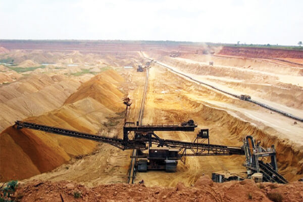
For the first time, the Department has made it mandatory to attach a Vehicle Tracking System (VTS) to trucks ferrying minerals from mines. If any vehicle has already installed VTS device, it should be linked with our command centre. This will give an update to the command centre during entry and exit from a mining area. We are leaving no stone unturned to stop illegal mining. On one hand, there are drones to keep an eye on mining activities from the sky, the minerals are being transported from the mining site to depots on trucks equipped with Global Positioning System (GPS), on the other.
In addition, eMM11 receipt (also called e-Ravanna) is being generated online with a tamper free QR code. After every boarding from a mine, a mining officer seals and scans the truck and receipt on the mobile app. It is checked by NIC server before sending it to command centre. The mineral storage data is available online district-wise and can be accessed by anyone from anywhere.
What are other future plans to strengthen the system?
With the help of Uttar Pradesh Development Systems Corporation Ltd. (UPDESCO), the Geology and Mining Department is planning to start a pilot project at Toll Plaza, Nawabganj, between Lucknow and Kanpur. Trucks registered with the Mining Department will be permitted to transport minerals and each truck will have Radio Frequency Identification (RFID) tags.
We are in talks with National Highway Authority of India (NHAI) to install CCTV cameras and RFID scanners at Toll Plaza that will send images to the command centre.
 Geo-fencing in the mining areas is also being set up gradually. It will enable us to curb mining in any area where a lease has not been issued.
Our aim is to minimise human intervention and move onto a comprehensive digital platform. Hence, drone cameras will be deployed to check whether the lease-holder is carrying out mining activities in the allotted area and in accordance with the quantity approved by the mining department.
We have a law enforcement mobile application, which is installed in the dedicated devices of all mining officers at the state and district level including District Magistrates and police officials.
If there is any complaint related to illegal mining, an alert goes to all the officials at one click for necessary action. In the near future, minerals can be booked online and will be delivered at the given address. By doing this, we are not only trying to ensure transparency in the system but also facilitating customers at their doorsteps.
How helpful is Photogeology and Remote Sensing (PGRS) in mineral exploration?
We have explored more than 205 new mining areas sprawling over 7,124 hectares through Photogeology and Remote Sensing (PGRS). It is the science of obtaining information about an object or area through the analysis of data acquired by a device that is not in contact with the object or area under investigation. Remote sensing data is interpreted on the basis of recognition element such as tone, colour, pattern, shape, size, association and shadow.
“In the near future, minerals can be booked online and will be delivered at the given address. By doing this, we are not only trying to ensure transparency in the system but also facilitating customers at their doorsteps.”
The work of geo-fencing in the new areas has been achieved 100 percent in 12 districts and is under progress in the remaining districts.
Remotely sensed data are critical for understanding earth resources as they can be collected even for the inaccessible geographic areas. Additionally, satellite data can be acquired repeatedly covering a large area. Based on the above interpretation Regional Geological, Geomorphological and tectonic maps of a large area are prepared in a very short span of time.These maps provide very useful information for detailed investigation aimed at mineral targeting and proximate sources of mineral wealth.

Be a part of Elets Collaborative Initiatives. Join Us for Upcoming Events and explore business opportunities. Like us on Facebook , connect with us on LinkedIn and follow us on Twitter, Instagram.
"Exciting news! Elets technomedia is now on WhatsApp Channels Subscribe today by clicking the link and stay updated with the latest insights!" Click here!