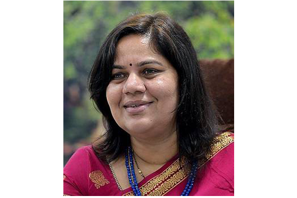
 Telangana has been at the forefront of implementing IT initiatives and urban reforms. The Municipal Administration and Urban Development Department (MAUD) of the youngest State of India has brought many of its services on a single e-platform to ensure time bound urban service delivery and transparency. In an interaction with Dr T K Sreedevi, Commissioner and Director of Municipal Administration, Sudheer Goutham of Elets News Network (ENN) finds more about the state’s citizen friendly e-initiatives.
Can you please tell us how is your department using technology in mapping and identifying properties in the state?
Under the land registry ease of doing business reform, the Commissioner and Director Municipal Administration (C&DMA), Telangana has embarked on a task to map and geo tag all properties including that of the government in urban areas. To integrate property information spatially by geo-tagging each property, the C&DMA in partnership with the Indian Space Research Organisation’s National Remote Sensing Centre (NRSC) has developed a special mobile application (BHUVAN app – an online platform that provides images and map visualisation) to geo-tag all properties. Registration and use of BHUVAN The NRSC developed a user-friendly mobile application and server-based solution to enable the data collector to systematically record generated assets with spatial position (longitude, latitude and attribute the status), time stamped with geo-tagged photograph.

This mobile app provides a platform to control crowd sourcing to build spatial database on the Bhuvan Geo-platform. The user can download the mobile app from Bhuvan Geo-platform using web browser in mobile by keying in the URL. The profile page consists of basic parameters such as Bhuvan User ID, Name, Mobile number and Urban Local Body (ULB). Along with these parameters, the user shall select the state, district, ULB to download property data of the ULB to be geo-tagged. The user is registered on the Bhuvan Geo-platform on approval by the revenue officer of the respective ULB. The mobile app is secured with a login id and is accessible only to the registered users, i.e., C&DMA, RDMA, municipal commissioner, revenue officer and bill collectors.
Each user is authorised by his supervising officer. The survey process As part of the survey process, each bill collector is designated an area in the ULB where the GPS is synced with the assessment data , the user needs to perform the following five tasks using the app i.e,

i) Select the property from the assigned list and opt for house number / assessment number, information if any about the work and
ii) Capturer the GPS ,
iii) Take photograph of the property (two photographs) a front and side angle of the property from a distance of 10 metres
iv) Add information if any about the work and
v) Send the collected information.
The bill collector then uploads the data to the concerned revenue officer for any moderation and subsequently approve or reject the property. The geo-tagged properties are linked to property data base of the Urban Local Body which provides all information on the property viz., name of the owner, tax details, building details, encumbrance, prohibited properties details and disputed properties to the citizen or buyer.
Other than tax the details such as encumbrance, prohibited properties and disputed properties are captured with due integration of data base of Registration Department and the end user can access the ULB website or the C&DMA website using the property tax assessment number or house number to search for the property information.
Throw some light on what has been the outcome of this initiative and how could you transform it into a revenue model?
The geo- spatial survey is entirely carried out by the bill collectors in an economical way by just using smart phones with android applications with no expenditure incurred. The entire project was undertaken by the staff of the urban local body. The NRSC had completed training 400 bill collectors in just two months so to carry out the survey. All the 12.5 lakh properties in 72 Urban Local Bodies (ULBs) of the Telangana State have been mapped through this process. The Geo-spatial database of properties is available on the public domain and citizens could view every detail information of the property online without visiting the ULB office.
This initiative has ensured transparency, ease of access to information online, time bound services and hassle-free services w.r.t property information. Further to the existing assessment a total of 21000 new/ un-assessed properties have been identified and geo-tagged.
Transformation into Revenue Model The application was kept to use in transforming into revenue model by identifying the under-assessed or un-assessed properties by matching their measurements with the satellite imagery which augmented the revenue in terms of property tax. All the new assessments mapped are made assessed and brought into tax net. Similarly all the properties which are mapped have been validated with the existing property tax data base and found a variation of nearly 42% in (72) ULBs. ULBs have been directed to verify these variation data and revise the same to actual tax.
This effort also brought improvement in ULB revenues to an extent of Rs 30 crores.
Tell us about the procedures and implementation of GIS based Revenue Improvement in Urban Local Bodies (ULBs).
It was critical to use GIS base maps for survey of properties to spatially represent the property locations. The GIS based property tax information survey was taken up in 34 ULBs with objective of using the geo-spatial information made available in the base maps. Out of 67 ULBs in the State, the new municipal tax brought into effect in 2015 in 27 Nagar Panchayats which were upgraded from Gram Panchayat. The GIS base maps soft copies were obtained and each property was assigned a unique number for the purpose of physical survey.
The field staff were provided with the base map with properties ward wise and were directed to identify each property as per unique number and complete the survey details viz., owner of the property/measurements etc. as required and as per the norms. After completing the process of all the properties assigned the same is verified with the existing MIS data base. On variation to the existing details, the existing assessments are re-assessed and similarly the details of the properties that are not in the tax net are also assessed.
Therefore, both un assessed and under assessed properties are assessed and brought into tax net. As a result, this initiative resulted in 27% increase over the existing demand and increased revenues to a tune of Rs 40 Crores.
How has been the e-Office exercise in the department? Could it yield the results towards transparency, speedy file clearance and movement?
Under the e-office system, each officer/ concerned staff was provided an e-mail ID and a digital key where in the concerned officer shall login and post the note files through the designated e-mail ID. The file then gets escalated to the next supervising officer and further on. The next level officer will check the note files and if officer is satisfied with the file the officer shall add comments and forward it to the next senior officer and in case of any changes are to be made, the note files will be reverted to the source from where it first originated with a recommendation to make necessary changes.
The electronic filing system resulted in speedy file processing, transparency and has facilitated 24 X 7 file movement, making it possible to receive files on days the office is officially closed, and extending the time for moving files on any given day till midnight. The e-Office system has been introduced in all the Head of Departments Regional Offices and also 72 Urban Local Bodies in the state. As a result, a total of 1,11,621 files/ receipts created so far and a total of 3,10,985 files/receipts are moved in e-office.
It is estimated that nearly 300 trees are saved in the past year in lieu of electronic filing system and avoiding papers.
Brief us about the ‘Citizen Services Monitoring System’ initiative taken up by your department?
To bring about effective monitoring and quick redressal of citizen services, Citizen Services Monitoring System have been introduced by C&DMA department. This system aims in providing transparent and time bound services to urban citizens. This system works as a bridge between the Municipal staff and citizens in handling the service applications, grievances effectively and helps in redressing them within a specified time while alerting the citizen on a time to time basis about the development at every stage.
Citizens get free access to the status of their application via sms alerts, App notifications, web access and on the other side, the concerned staff are alerted on their performance, disposal rate with information made available to the senior officers for effective monitoring. As the citizen applies for any service or registers a grievance it gets recorded and the central system generates a unique number for future tracking purpose. Based on the nature of complaint or service application, location from where it is received, the pre-defined intelligence system assigns the complaint to concerned staff for resolving.
As the complaint is assigned an SMS alert will be sent to the concerned officer with the details of complaints, complainant name, mobile number, grievance information and time of disposal where concerned staff can get in touch with complainant for more information. At the same time, another SMS alert is sent to the complainant with the concerned officer’s mobile number, name and designation for follow-up which ensures that communication barriers are broken and system is made transparent for quick resolution.
A centralised and ULB level dashboard is established with required reports on applications received and redressed along with details to ensure time bound service delivery and effective monitoring. So far 1,40,654 applications/complaints have been addressed as against 1,49,977 received.
Mobile Application- Citizen Buddy The Citizen Buddy mobile application (available on google play store) enables any user to place grievances / access any ULB information. In the case of a grievance the request is registered and a notification is directed to the concerned officer and the citizen via SMS alert with all particulars. The two-way communication feature in the App breaks communication barriers and establishes the connectivity that helps handling grievance within time. As the grievance is redressed, the concerned officer updates the status and same is intimated to the citizen. The app user has an option to upload image of the grievance with geo location where staff can respond with the same image as evidence of redressed. The citizen buddy app is also integrated with the Swachata App. 23 urban services have been integrated in the app which includes property tax payments, trade licenses, water connections, road cutting permissions, building permissions, birth/death certificates, officers connect, etc.
How are the building and layout permissions being accorded using technology in the department?
As a part of the Government of Telangana’s plan to bring about an ICT-enabled Integrated Online Building Permission Management System in the ULBs, the Development Permission Management System (DPMS) was launched on June 2016. DPMS portal is a gateway for according permissions related to buildings and layouts. The objective is to ensure transparency and avoid human intervention in applying and getting approval of building permission. The integrated system enables quicker, transparent procedure and provide good governance to citizens with respect to ‘Building’, ‘Change of Land Use’, ‘Layout’, & ‘NOC’ permissions.
The user selects the link of ‘Registration as Architect or Citizen (as the case may be), completes the registration process and after completion of the registration process, the entered User-ID and password will be sent via SMS/email that is provided at the time of registration. The Citizen/Architects can upload documents and plan using AutoCad software online as per the checklist made available in the online application. Once all the documents are uploaded, payment of initial fee needs to be made online through an Integrated Payment Gateway. As a next step, a file number is generated and an SMS is sent to the Citizen /Architect. Status of the file is automatically updated on the website and an SMS message is sent at every stage i.e. inspection, shortfall letter/ rejection letter, fees intimation letter, permission plan and proceedings. After the final approval, the building permission order and sanction plan is sent via email and made available for download.
The Development Permission Management System is presently implemented in all the (73) Urban Local Bodies in the state including the Urban Development Authorties. The DPMS has simplified and standrardized the approval process. It has also brought in transperceny and accountbility with time limits for each processes, systematic monitoring and auto escalation to senior officer to act on delays with real time information on dashboards. The system has a integrated document management process for easy storage and retrieval of digital documents at any date. Till date in 73 ULBs 58,365 applications were recieved on the DPMS portal of which 54,788 have been approved and 3,577 have been rejected.
Be a part of Elets Collaborative Initiatives. Join Us for Upcoming Events and explore business opportunities. Like us on Facebook , connect with us on LinkedIn and follow us on Twitter, Instagram.


