“Minimum Government, Maximum Governance” is a guiding principle that aims at achieving efficient, transparent, and citizen-centric governance with minimal administrative intervention. In the Land Records Department context, this concept entails transforming the administrative framework to reduce ground-level hurdles, enhance service delivery, and ensure effective land records management.
Historically, the land records survey and settlement began in 1840 and created various types of parcel/cadastral maps (tippan, village maps) and textual data in the form of registers for the Bombay Presidency, Marathwada, CP & Berar. These records provide a legacy of land holdings, tenure, area, boundaries, land revenue, etc., for each land parcel. In Maharashtra, important land reforms were implemented, such as the Bombay Prevention of Fragmentation and Consolidation of Holdings Act, 1947, which came into force to create economically viable holdings and to put restrictions on the creation of fragments. Land consolidation resulted in improved socio-economic infrastructure and the implementation of developmental and environmental policies (improving environmental sustainability and agriculture), resulting in the preparation of an updated land records database showing Gat numbers instead of survey numbers.

Over time, subdivisions were made in the lands/survey numbers due to succession or sale and purchase. These survey numbers are often recorded only in the record of rights (7/12) but not mapped in the Tippan or village maps. There are around 56 lakh map sheets (field measurement books) of different types and 2.6 crore 7/12 records. Owing to such a voluminous database, the department often faced several challenges, including inefficiencies in record-keeping and its manual updating, leading to difficulties in land ownership verification, lack of transparency, and integration of textual records of rights data and cadastral map data. These issues hindered effective governance and imposed significant hurdles for citizens seeking land-related services such as registration, mutation, and obtaining property documents.
The Significance of IT Interventions in Driving Growth

In the last decade, the Government of Maharashtra has embarked on a transformative journey to modernise its Land & Records Department through the implementation of Information Technology (IT). This initiative aims to streamline operations and enhance the transparency, efficiency, and accessibility of land-related services for citizens and stakeholders across the state.

The transformation of Maharashtra’s Land Records Department began with digitising land records. This involved converting physical records into digital formats, thereby reducing dependence on paper-based records, which are susceptible to data loss over time, damage, and manipulation. The digitisation process was meticulous, involving scanning, indexing, vectorisation, georeferencing, and data entry to ensure accuracy and completeness.
The First-In-First-Out (FIFO) feature has been implemented for Mutation and eMojani services. Citizens can now track the status of their applications online, reducing the scope for corruption and ensuring accountability.
The key objectives of this initiative include:
• Digitisation of Textual Land Records: One of the primary goals was to digitise textual land records to ensure their safekeeping, accessibility, and retrieval. This involved scanning and converting physical records into digital formats using metadata, which are easier to manage and retrieve.
• Online Services: As per the Maharashtra Right to Public Services Act, 2015, various services such as property registration, mutation applications, and land survey/measurement requests have been made available online to enhance citizen convenience and provide time-bound services. This allows citizens to access these services from anywhere at any time, minimising the need for physical visits to government offices.
• Integration and Interoperability: IT systems have been designed to integrate various departments involved in land management, such as IGR, Town Planning, Banks, Digital Crop Survey (Ministry of Agriculture, GoI), Insurance Companies, Relief and Rehabilitation Department, and GATISHAKTI of NITI Aayog. This APIlevel integration ensures seamless data flow and reduces duplication of effort.
• Transparency and Accountability: The government aimed to increase transparency in land transactions by digitising records and processes. Dashboards have been implemented, enabling supervisory officials to track service deliveries in real-time and take corrective measures. The First-In-First-Out (FIFO) feature has been implemented for Mutation and eMojani services. Citizens can now track the status of their applications online, reducing the scope for corruption and ensuring accountability.
• Capacity Building: The Land Records Department also invests in training personnel to operate and maintain IT systems effectively. Capacity-building initiatives ensure that stakeholders are equipped with the necessary skills to leverage technology for better service delivery.
• Adoption of Latest Technology: The Land Records Department has now switched from conventional survey techniques such as Plane Table, Theodolite, and Electronic Total Station (ETS) to the latest Global Navigation Satellite System (GNSS)-based technology using Rovers and Continuously Operating Reference Stations (77 nos.) in Maharashtra. This has resulted in improved survey efficiency and accuracy.
Major Successful IT Projects of the Land & Records Department
1. MahaBhumi Portal (https://mahabhumi.gov.in/ mahabhumilink): MahaBhumi is Maharashtra’s flagship online portal for the Land Record Department. It provides citizens with access to premium and free services such as:
• Digitally Signed 7/12, 8A, Property Card, and eRecords
• Archived Documents (eRecords)
• Maha-Bhunaksha (GIS portal)
• e-Chawadi Citizen Portal
• e-Mojani (for Land Measurement)
• e-Hakka (online application for Mutation)
• Aapali Chawdi (Village Digital Notice Board)
• Civil Court Case Status Information for Record of Right
The portal has significantly reduced the need for physical government office visits, thereby saving citizens time and resources. The department received over 100 crores in fees for offering citizens premium services, and that same sum is being utilised to introduce IT interventions aimed at improving services.
Also Read :- Maharashtra’s Roadmap to a $1 Trillion Economy by 2028 Leading India in FDI, GDP, and Exports
Statistical data till June 2024 from the inception of the IT initiative:
• All digital 7/12 records: 2.6 Crores
• Total Online Mutations: 2.08 Crores
• Total Digitally signed 7/12: 2.57 Crores
• Digitally signed 7/12 downloads: 6.45 Crores
• Digitally signed 8A downloads: 2.03 Crores
• Digitally signed Mutation downloads: 24 Lakhs
• Total number of Property Cards: 79 Lakhs
• Total Villages (as of date): 0.44 Lakhs
• Departments and allied offices using digital data: 106
2. e-Peek Pahani: The Government of Maharashtra initiated this project in 2021 to allow individual farmers to record their season-wise crops using a mobile application under the project “e-Peek Pahani,” with the slogan “माझी शेती, माझा सातबारा, मीच नोंदवणार माझा पीक पेरा.” Talathi verifies ten per cent of recorded crop details in the mobile app and finally added to the year-wise crop register (Register 12). This application is highly successful in Maharashtra State and is being used by 2.13 crore farmers. The success of this application led to the development of the Digital Crop Survey application (jointly with the Central Government).
The database generated every year is used for various schemes such as:
• Minimum Selling Price Scheme (MSP) by the Food Supply Department
• Crop Insurance Scheme
• Crop Loan Disbursement
• Natural Calamity Compensation using the e-Panchnama app of the Relief and Rehabilitation Department.
3. eMojani 2.0 & Maha-Bhunaksha: GIS technology has been employed for:
• Measuring land parcels under the eMojani 2.0 application for generating “K-Patra” showing land measurement map with GIS coordinates
• Visualising land parcels accurately on a Geoportal – “MahaBhunaksha” – only for Survey/Gat number of a village
• A new Geoportal is envisaged to cater to more than 50 GIS layers integrated/consuming WMS/WFS services with GatiShakti, MRSAC Satellite data, the Building Permission Management System, Councils and Corporations, central government agencies, and other open-source GIS datasets. The Geoportal shall help with precise land identification, boundary demarcation, infrastructure project planning, and a decision-support system for land use planning and development.
4. Maha-Swamitva: The Land Records Department has implemented drone-based surveys in 30,589 villages over the last 5 years, preparing property maps for 18,977 Gaothans. So far, 21.6 lakh property cards have been created. This activity is being carried out on a war footing to complete all remaining villages.
5. R&D Activity: Georeferencing of Survey Maps: Research and development activity is also being carried out with support from IIT-B to automate georeferencing and groundtruthing of village survey maps using farm plots derived from satellite data.
Achievements and Impact
The implementation of IT in the Land Records Department of Maharashtra has yielded significant benefits and a profound impact on governance and society. The key areas of impact include bringing transparency and accountability, improving efficiency in service delivery, reducing disputes, promoting entrepreneurship, and facilitating economic development in the state.
Prospects for the Future of the Land Records Department
Looking ahead, the Office of the Settlement Commissioner and Director of Land Records (Maharashtra State), Revenue Department, aims to establish a state-of-the-art Geoinformatics system for land record surveys. This initiative will incorporate various emerging technologies in surveying, such as blockchain for secure transactions and artificial intelligence for data analytics. Urban Swamitva mapping using drone technology and LIDAR for 3D mapping (vertical properties) are also under consideration for all cities in Maharashtra.
These efforts are expected to develop an Integrated Land Management System (ILMS) designed to serve different government and non-government entities and citizens. The ILMS will cover various aspects of land administration, including registration, survey, mutation, and dispute resolution. It will ensure data consistency across different departments, minimise duplication of efforts, enhance coordination among stakeholders, and provide timely and efficient service delivery to citizens, especially in rural and urban areas.
A modern, comprehensive, real-time land record management system is crucial for optimising the use of land resources, assisting in policy-making and planning, reducing land disputes, and eliminating the need for physical visits to land revenue offices.
National-Level Initiatives
In alignment with these goals, the Government of India plans to launch a project to apply global standards to the land management system in India under the Department of Land Resources, Ministry of Rural Development. The project aims to create a “Digital Public Infrastructure” with standards for geospatial data. As part of this initiative, the development of a “Land Administration Domain Model” has been undertaken by the Department of Land Resources (DoLR), Government of India. Given its advanced and developed land management systems, Maharashtra has been selected as a test bed for the “Land Administration Domain Model,” serving as a platform for conducting rigorous, transparent, and replicable testing.
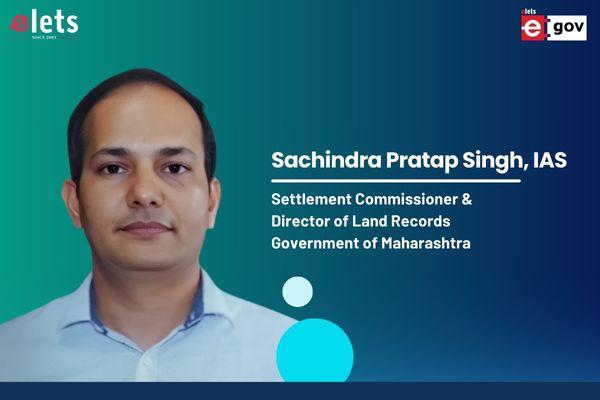
Insights shared by: Shri Sachindra Pratap Singh, IAS, Settlement Commissioner & Director of Land Records, Government of Maharashtra
Be a part of Elets Collaborative Initiatives. Join Us for Upcoming Events and explore business opportunities. Like us on Facebook , connect with us on LinkedIn and follow us on Twitter, Instagram.
"Exciting news! Elets technomedia is now on WhatsApp Channels Subscribe today by clicking the link and stay updated with the latest insights!" Click here!


